
Special Assignments
Ground Probing Radar
Ground probing radar (GPR) is a high resolution, field-portable geophysical method that produces graphic sections of subsurface structure. It is capable of working through a wide variety of surface materials both inside and outside buildings and structures. Ground radar surveys are non-destructive and non-intrusive, revealing detailed information on subsurface ground conditions without the requirement for drilling or excavation.
Site Investigation Applications
- Accurately locate voids, cavities and buried obstructions
- Map subsurface soil and rock interfaces
- Determine depth of bedrock and overburden thickness
- Define buried foundations and archaeological structures
- Identify position of pits, ditches, and ancient landfill sites
- Track non-metallic culverts and sewers
- Detect buried hazardous waste and underground storage tanks
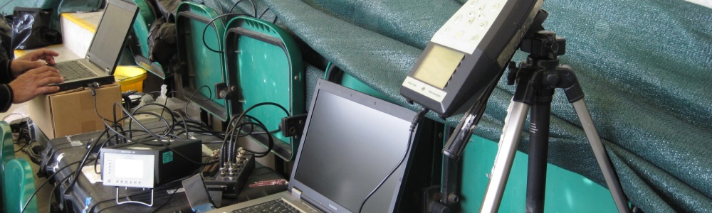
GPR Equipment
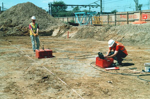
The antenna unit is in direct ground contact, with the remaining equipment either vehicle-mounted or stationary. Data is collected along accurately located profiles, usually set-out in a customised survey grid. Variable frequency, interchangeable antenna units can be used with the GPR system, depending on the particular application. Low frequency units offer greater depth penetration and are generally better suited for civil engineering and geological site investigations. Small, portable, high frequency units are used for high resolution work involving NDT of concrete and masonry structures.
GPR Operation
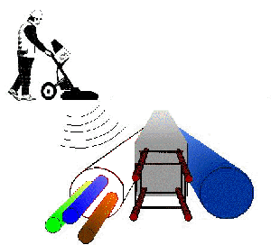
Ground radar works by transmitting impulses of electromagnetic energy from the moving antenna, which are propagated downwards into the ground. Reflections are generated at any subsurface boundary where an electrical contrast is present. The reflected signals are detected by the antenna receiver and digitally stored by the control console for post-survey processing and interpretation. The scans produce a scrolling picture of scans as the antenna is moved across the search area.
Data Processing
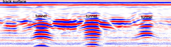
Data processing is carried out using specialised interactive software to optimise survey results. Data interpretation procedures correlate reflections on the GPR record with real physical interfaces such as soil or rock layering, voids, foundations and archaeological structures.